
Greater predictability of floods in Sumatra possible thanks to the Polish studies
Heavy rainfalls are common on the Indonesian island. Landslides and floods make up over 50% of all natural disasters there. It turns out that extreme phenomena can be predicted with greater accuracy. Dariusz Baranowski, PhD from the PAS Institute of Geophysics carries out research on this subject. His team's findings has just been published in the prestigious Nature Communications journal.
The Malay Archipelago (the area between mainland Asia and Australia, including parts of Indonesia) is probably the most important region for the global weather system. The processes taking place in the distant Malay Archipelago shape the weather in our part of the world, among others they impact weather conditions in Central and Eastern Europe.
"However, we still know very little about the interactions between the atmosphere, the land surface, and the oceans. Our research leads to better understanding of the occurrence of the weather-related natural disasters," explains Dariusz Baranowski, PhD.
Collecting data
An international team of scientists has looked closer to Sumatra, island most frequently hit by floods. Can we more accurately predict where the flood is likely to happen? Scholars analyzed the 2014-2018 flood period by studying rainfall and wind records derived from different sources, including governmental reports, Twitter messages and local newspaper’s reports. As a result, they identified key weather phenomena responsible for floods.
Conditions conducive to extreme precipitation
Scientists analyzed the impact of:
• monsoons,
• tropical waves,
• the Madden-Julian Oscillation (MJO) – an organized system of storm clouds moving along the equator.
The results show that flood occurrence is to some degree associated with monsoonal flow and MJO precipitation anomalies (the major fluctuation in tropical weather on weekly to monthly timescales). The findings of this research are consistent with previous studies.
The researchers, however, pointed out a new, significant cause of the floods in Sumatra. These are convectively coupled Kelvin waves (CCKWs – is a type of tropical wave) that propagate eastward (along the equator) and affect local atmospheric conditions.
30% of flood events were attributed to Kelvin waves only. However, when CCKWs occurred with monsoons, MJO or both phenomena simultaneously – they were responsible for over 65% of flood events in the area.
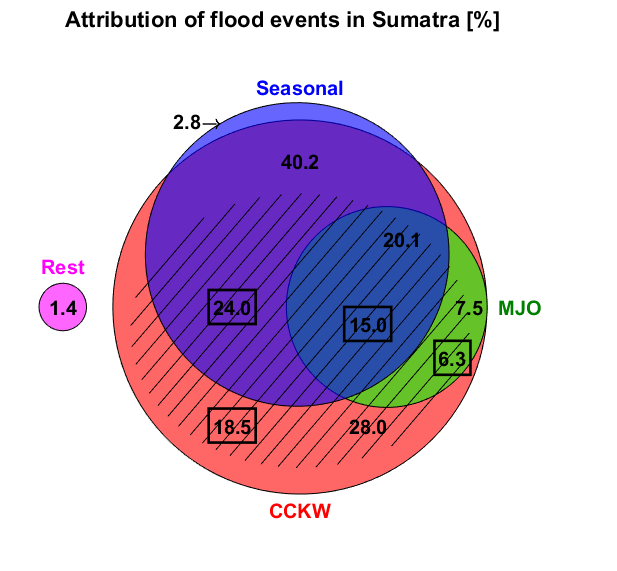
Causes of floods in Sumatra. The diagram shows that Kelvin waves are responsible for the largest part of the floods. Each color represents one of the three processes analyzed. Total area of the red circle represents 95.8% of floods associated with convectively coupled Kelvin waves (CCKWs). Total area of the green circle represents 27.6% floods associated with MJO. Total area of the blue circle represents 63.1% of the monsoon floods. The pink circle represents 1.4% of all floods that were not attributed to either category considered.
Early flood warning
Reliable long-range forecasts are crucial for crisis management and minimizing the socioeconomic costs of floods. Almost 60% of floods in Sumatra were associated with Kelvin waves during the period considered. Kelvin waves appeared on satellite data at least 2 days before approaching Sumatra.
Scientists emphasize that forecasts for a longer period are also possible because we understand better the processes affecting rainfall and the nature of tropical waves.
Authors of the publication
Dr. Dariusz Baranowski is an atmosphere physicist, who combines theoretical research with experimental methods as well as meteorology with oceanography and hydrology. He completed numerous scientific internships in leading research centers in Europe and the US.
At present he works at the Institute of Geophysics of the Polish Academy of Sciences.
He leads an international team of researchers:
• Maria K. Flatau, PhD and Jerome Schmidt, PhD (Naval Research Laboratory),
• Piotr J. Flatau, PhD (Scripps Institution of Oceanography),
• Dwikorita Karnawati, PhD (director general of the Indonesian Agency for Meteorology, Climatology and Geophysics - BMKG),
• Katarzyna Barabasz (Collegium Civitas),
• Michal Labuz and Beata Latos (PAS Institute of Geophysics),
• Jaka A. I. Paski (BMKG),
• Dr. Marzuki (Andalas University).
The results have been published in Nature Communications (May 19, 2020).
Source of information and graphics: PAS Institute of Geophysics
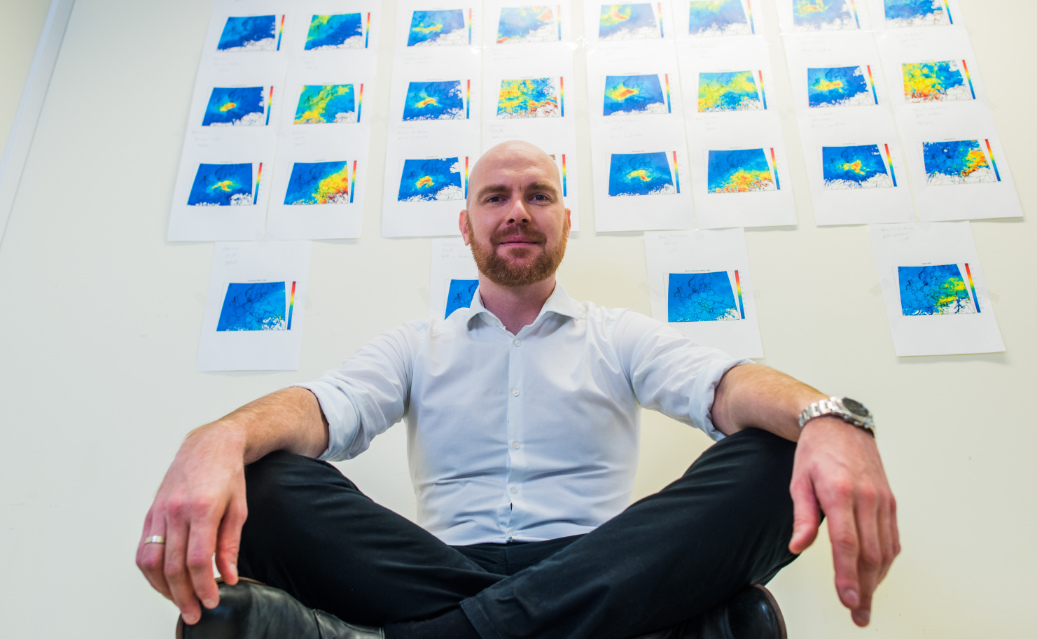
In the photo: Dariusz Baranowski, PhD (photo from the private archives of the researcher, taken by Foundation for Polish Science)